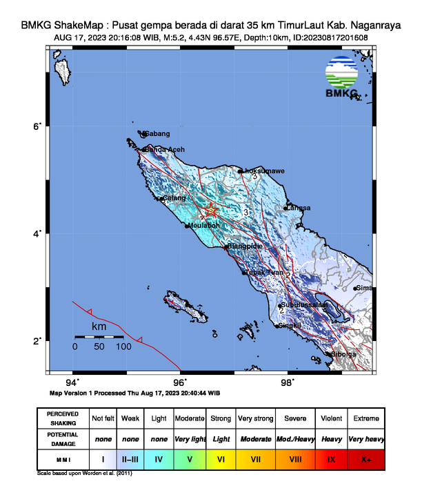
Date & time: Aug 17, 2023 13:16:08 UTC
Local time at epicenter: Thursday, Aug 17, 2023 at 8:16 pm
Latitude/ Longitude: 4°25'48.0"N 96°34'12.0"E
Epicenter: Hutan, Beutong, Nagan Raya Regency, Aceh
Magnitude: 5.2
Depth: 10.0 km
Waveform
Listen to the waveform as audio:
ShakeMap

Nearby towns/cities
- 58.58 km (36.40 mi) NE of Meulaboh, Aceh
- 104.79 km (65.11 mi) SW of Lhokseumawe, Aceh
- 126.48 km (78.59 mi) SSE of Sigli, Aceh
- 156.03 km (96.95 mi) W of Langsa, Aceh
- 186.18 km (115.69 mi) SE of Banda Aceh, Aceh
MMI (Modified Mercalli Intensity) Scale:
- III Takengon
- III Bener Meriah
- III Aceh Tengah
- III Aceh Jaya
- II Aceh Besar
Find us on
- Instagram: earth4444_
- Tiktok: @earth.44_
- Telegram: earthquake44
- Youtube: @earth44

