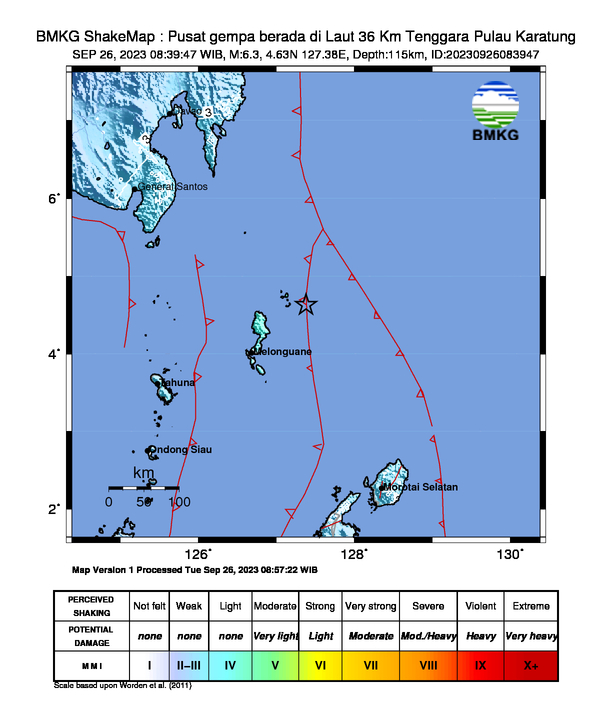
Date & time: 2023-09-26 01:39:46 UTC
Local time at epicenter: Tuesday, Sep 26, 2023 at 9:39 am
Latitude/ Longitude: 4°37'48.0"N 127°22'48.0"E
Epicenter: Philippine Sea
Magnitude: 6.3
Depth: 115.0 km
Waveform
Listen to the waveform as audio:
ShakeMap

Nearby towns/cities
- 32.4 km (20.2 mi) ESE of Dampoelis, Kepulauan Talaud Regency, North Sulawesi
- 108.4 km (67.4 mi) NE of Kolongana, Kepulauan Talaud Regency, North Sulawesi
- 113.5 km (70.5 mi) NE of Salebabu, Kepulauan Talaud Regency, North Sulawesi
- 233.4 km (145 mi) SE of Pondaguitan, Davao, Philippines
- 239.2 km (148.6 mi) NE of Tahuna, Sangihe Islands Regency, North Sulawesi
- 244.9 km (152.2 mi) ESE of Caburan, Davao, Philippines
- 281.1 km (174.6 mi) SE of Malita, Davao, Philippines
- 281.2 km (174.8 mi) ESE of Malapatan, Soccsksargen, Philippines
- 334.3 km (207.7 mi) SE of Davao, Davao, Philippines
MMI (Modified Mercalli Intensity) Scale:
- IV Essang
- IV Rainis
- IV Beo
- IV Lirung
- IV Mangarang
- III - IV Talaud
- III Siau
- III Pondaguitan
- III Luzon
- III Surup
- III Nangan
- III Tiblawan
Find us on
- Instagram: earth4444_
- Tiktok: @earth.44_
- Telegram: earthquake44
- Youtube: @earth44

